The Great Trigonometrical Survey
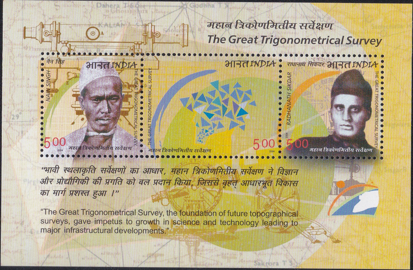
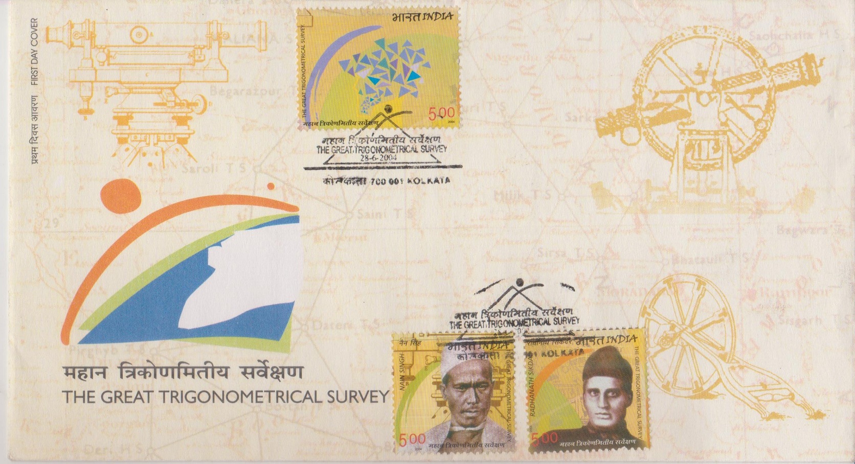
A Miniature Sheet consisting of 3 nos of commemorative postage stamps on the Great Trigonometrical Survey, project to measure entire Indian sub-continent with scientific precision by Survey of India : Nain Singh Rawat and Radhanath Sikdar :
 Issued by India
Issued on Jun 28, 2004
Issued for : The Department of Posts is proud to release a set of postage stamps to commemorate the “Great Trigonometrical Survey”.
Design : The stamp features two of the greatest contributors to the Survey – Radhanath Sikdar and Nain Singh besides depicting the theodolites and other instruments.
Credits :
Stamp & FDC : Kamleshwar Singh
Cancellation : Alka Sharma
Type : Miniature Sheet, Mint Condition
Colour : Multicolour
Denomination : 500 Paise each
Stamps Printed : 0.8 Million
Miniature Sheet : 0.05 Million
Printing Process : Photo Offset
Printer : Calcutta Security Printers Ltd.
About :
- The Survey of India, the premier mapping agency of the country, was raised during the era of the East India Company, by Lord Clive. Major James Rennell was commissioned to commence the Bengal Surveys in 1767 as the first Surveyor General of the Bengal Survey. This is accepted as the beginning of systematic topographical mapping in India and the founding of one of the oldest survey and mapping agencies in the world. Soon after the conquest of Mysore in 1799, the third Mysore surveys were ordered under Colonel William Lambton. At that time, the detailed knowledge of the earth’s size and shape did not exist. So, in 1802 AD, Colonel Lambton decided to carry out a trigonometrical survey of the peninsula in the vicinity of Madras on 10 April, 1802, starting an exercise that marked the beginning of the Great Trigonometrical Survey (GTS).
- The Royal Geographical Society considered the GTS the most significant contribution to the advancement of the science in the 19th century. Though Lambton had initially planned a short arc, it later grew in size and scale to become one of the most ambitious and adventurous scientific undertakings known to man. The 1600 mile survey took nearly fifty years to be completed, involved equations more complex than any in the pre-computer age and covered inhospitable and perilous terrain from the southern tip of the Indian sub-continent into the frozen wastes of the Himalayas. The Great Arc made possible the mapping of the entire subcontinent. Scientific and infrastructural initiatives could not have taken place without the accurate maps which the measurement of the Great Arc made possible. The Arc also resulted in the first accurate measurement of the Himalayas and significantly advanced our knowledge of the exact shape of our planet by producing new values for the curvature of the earth’s surface.
- This gigantic endeavour would not have been possible without the pioneering efforts, clear thinking and sagacious vision of an intrepid band of surveyors. Foremost among them is Colonel William Lambton, a man of extraordinary scientific passion. A self-taught astronomer, geographer and mathematician, he joined the British Army as an ensign in the 33rd Regiment and moved with his Regiment to India when he was almost 50 years of age. It was his desideratum most sublime to determine by actual measurement the magnitude and figure of the earth. The brilliant executor of Lambton’s scientific legacy was George Everest who made the Arc his life’s work. The loftiest peak in the Himalayas and consequently in the world was given his name: an acknowledgement of the painstaking, scientific endeavour that made possible the measurement of the snow-capped Himalayas. Everest’s “right hand” and Chief Computer was Radhanath Sikdar who joined the Survey at Mussoorie at the age of 21. He was appointed as computer in 1831 and took field with Everest in October 1831. He is said to have calculated the height of Mount Everest and thereby discovered the highest mountain in the world. His most important contribution was the preparation of the first edition of the Auxiliary Tables. He also assisted in the compilation of “Manual of Surveying for India“. After Everest’s departure he was equally trusted by Waugh, the new Surveyor General. He retired in March 1862 and passed away on 17 May, 1870.
- Another intrepid schoolteacher who made an invaluable contribution to the advancement of the Survey was Nain Singh. He took up the challenge of mapping Tibet and that too under cover since Tibet was completely sealed off by edict. Nain Singh entered Tibet in the guise of a lama, armed with prayer wheel and rosary but concealing in a secret compartment in his trunk precious instruments – the compass, sextant, thermometer, chronometer and bottle of mercury. Over 21 months, he surveyed the 2000 km trade route, took 31 latitude fixes and determined elevations at 33 places. He followed the course of the great Tibetan river, the Tsangpo for 800 km and eventually proved that Tsangpo and Brahmaputra are the same.
- Text : Based on material given by the proponent.